RSC4Earth
RSC4Earth
Home
Mission
Team
Principle Investigators
Remote Sensing in Geo- and Ecosystem Research
Earth System Data Science
Remote Sensing Department at the UFZ
Geoinformatics and Remote Sensing
Support
Projects
Publications
Featured Publications
Recent Publications
Contact
Data
AI
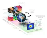
ARCEME
Use high resolution remote sensing data and machine learning to develop
A
daptation and
R
esilience to
C
limate
E
xtremes and
M
ulti-hazard
E
vents
Follow
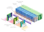
TEE Cube
Time-varying AI-based mapping of ecosystem conditions and extents using multi-source Earth observation data cubes - TEE cube
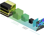
DeepFeatures
This project aims to create an holistic datacube with latent space variables based on Sentinel-2 spectral indices
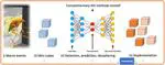
DeepExtremes
Develop and test novel artificial intelligence explanatory tools to decipher compound events (e.g., drought and heatwave) based on “mini-cubes” with high spatial resolution.
Follow
Cite
×