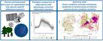
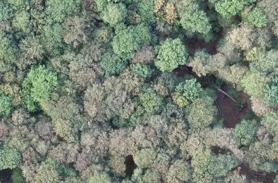
Remote Sensing Centre for Earth System Research
Leipzig is a vibrant hotspot for creativity in eastern Germany, known for its world-class research in biodiversity and ecosystem research and related areas. The Faculty of Physics and Earth System Sciences at Leipzig University and the Helmholtz Centre for Environmental Research (UFZ) haved teamed up and established the Remote Sensing Centre for Earth System Research to expand research in this area and better understand ecosystems in a changing world
Mission
-
How will geo- and ecosystem functions respond to the global environmental and societal transformations?
-
What are the spatiotemporal dynamics of change in the land-atmosphere water, energy, and carbon feedback systems?
-
How can we quantify and assess Biodiversity-Ecosystem-Functioning (BEF) relationships across scales?
-
How can we best integrate remote sensing techniques and modeling frameworks to improve our understanding of the Earth system?
Answering fundamental research questions of this kind and developing the right tools for this endeavour is the scientific mission of the RSC4Earth. Also key to our mission is preparing the next generation of Earth system sciences for addressing this quest.
Principal Investigators
Miguel D. Mahecha
Professor for Earth System Data Science
Jian Peng
Professor for Hydrology and Remote Sensing / Head of Remote Sensing Department (UFZ)
Michael Vohland
Professor for Geoinformatics and Remote Sensing
Remote Sensing in Geo- and Ecosystem Research
The Remote Sensing in Geo- and Ecosystem Reserach (RSGE) group uses Earth observation data and in-situ measurements to analyze spatio-temporal pattens in the biosphere. We model, map and monitor functional ecosystem properties, species composition and diversity to assess effects of human impacts, climatic extremes and other drivers of ecosystem changes. In these analyses, we put an emphasis on the fuzziness of spatial patterns in ecosystems and develop methods to map them as continuous fields using remote sensing data. We aim to address (geo-)ecological problems in a spatial context to gain insights in the composition and the functioning of the terrestrial biosphere.
Armin Anwar
PhD Candidate in the Jena Experiment project
Claudia Guimarães-Steinicke
Principal Investigator in the Jena Experiment Project and Lecturer
Julia S. Joswig
Postdoctoral scientist of the Breathing Nature initiative, FlexFund project, and member of the working group sPectra
Antonia D. Ludwig
Postdoctoral scientist in the SQUEEZE project
Swapna Mahanand
Postdoctoral associate
Karin Mora
Postdoctoral fellow in the DeepFeatures project
Soroor Rahmanian
Postdoctoral fellow
Kai J. Weber
PhD candidate in the BioSmoke project
Earth System Data Science
The Earth System Data Science (ESDS) group embraces a wide array of highly relevant research questions via data-driven research. Example questions from our researchers are:
- How do ecosystem functions respond to climate extremes?
- Which changes in societal and environmental pre-conditions trigger societal vulnerability to environmental hazards and what are the feedbacks?
- How can we quantify nonlinear interactions in coupled Earth system dynamics?
- What do novel citizen science data tell us about macroecological processes?
We assume that long-term observations encode the necessary knowledge to answer these questions in the different domains of the coupled Earth system and human activity. Hence, we mainly focus on developing methods to extract the valuable information in these data in order to confront them with models, and gain new insights.
Tobias Braun
Research fellow in the ARNETLAB project
Ida Flik
Research fellow in the NFDI4Earth project
Sarah Habershon
Research assistant in the COCAP project
Guido Kraemer
Postdoctoral associate
Miguel D. Mahecha
Professor for Earth System Data Science
Milena Mönks
Scientific project coordination
David Montero
Research fellow in the Flexpool project
Clemens Mosig
PhD student in the ML4Earth project
Kolja Nenoff
Scientific coordination in the NFDI4Earth project
Julia Peters
Research fellow
Maximilian Söchting
PhD candidate in the DeepESDL project
Daria Svidzinska
Guest researcher funded via the Alexander von Humboldt Stiftung
Khalil Teber
Research fellow in the ARCEME project
Sebastian Wieneke
Postdoctoral associate
Sophie Wolf
Scientist in the NFDI4Biodiversity project
Remote Sensing Department at the UFZ
The Remote sensing department in UFZ aims to develop novel remote sensing products to capture land surface water and vegetation dynamics. It will fully leverage multi-monitoring techniques that allow observing vegetation characteristics, soil moisture and evaporation dynamics at different spatiotemporal scales. The retrieved products and established processing framework will be applied to evaluate and integrate with the hydrological model system mHM, and the forest model FORMIND and to bridge the gap to biodiversity ground assessments. It is envisaged to provide a better prediction of the impacts of climate and land use change on the environment.
Francisco José Cuesta-Valero
Research Fellow
Daniel Doktor
Senior Scientist & Group Leader of Land Cover & Dynamics
Almudena García-García
Postdoctoral scientist
Maximilian Lange
Land Cover & Dynamics / Postdoctoral scientist
Xueying Li
Postdoctoral scientist
Jian Peng
Professor for Hydrology and Remote Sensing / Head of Remote Sensing Department (UFZ)
Elisabeth Rahmsdorf
Land Cover & Dynamics / PhD candidate
Geoinformatics and Remote Sensing
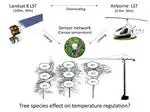
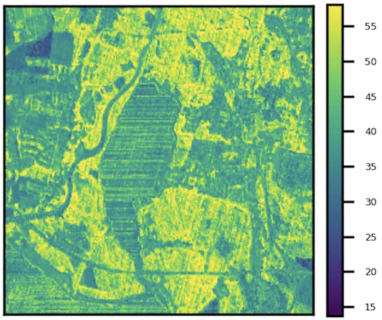
The focus of the Geoinformatics and Remote Sensing Group (GeoRS) lies in the evaluation of multispectral and hyperspectral remote sensing data, the application of imaging and non-imaging laboratory and field spectroscopy as well as spatial modeling with geographic information systems, numerical simulation models and geostatistical methods. We use optical remote sensing data in different spatial and spectral resolutions to inventory the state of diverse eco- and geosystems, to record their dynamics and to analyze systemic functions. We combine this information with pedological, vegetation-related, hydrological or sedimentological terrain data in order to analyze landscape conditions and dynamics at various temporal and spatial scales. In addition to laboratory spectroscopic methods, another focus of the working group is the acquisition and evaluation of field spectroscopic data. On the one hand, these provide spatially high-resolution, hyperspectral inventory data (e.g. in the area of "digital soil mapping" or the sociological characterization of vegetation), on the other hand they allow the spectral connection with multispectral and hyperspectral image data recorded from different remote sensing platforms. The integration of satellite image data (reflective, thermal) in spatial modeling approaches, e.g. for the analysis of spatial distribution patterns of remote sensing sensitive model variables and simulation results is an important issue in our group. Current work relates in particular to habitat modeling and the linking of remote sensing data with mesoscale hydrological process models, the latter for example by retrieved LST and ETa patterns.
Christopher Hutengs
PhD candidate
Michael Seidel
PhD candidate
Michael Vohland
Professor for Geoinformatics and Remote Sensing
Support
Angelika Brachmann
Office management
Andreas Schmidt
Scientific Technician & Research Software Engineer (UFZ)
René Voigt
Physical lab technician / Technical employee
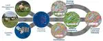
Projects
AIReSVeg: AI and Remote Sensing for Vegetation Monitoring
Developing advanced tools to monitor and analyze vegetation dynamics, enabling better understanding and management of biodiversity and ecosystem health.
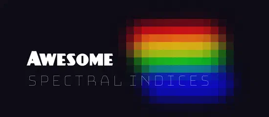
Awesome Spectral Indices
A ready-to-use curated list of Spectral Indices for Remote Sensing applications.
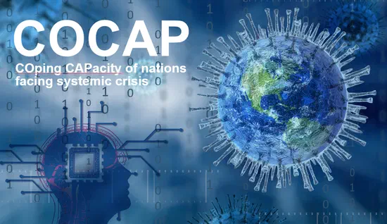
COCAP
COping CAPacity of nations facing systemic crisis – a global intercomparison exploring the SARS-CoV-2 pandemic.
Cubo
Easily create EO mini cubes from STAC in Python.
DeepExtremes
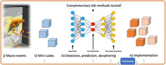
Develop and test novel artificial intelligence explanatory tools to decipher compound events (e.g., drought and heatwave) based on “mini-cubes” with high spatial resolution.
DeepFeatures
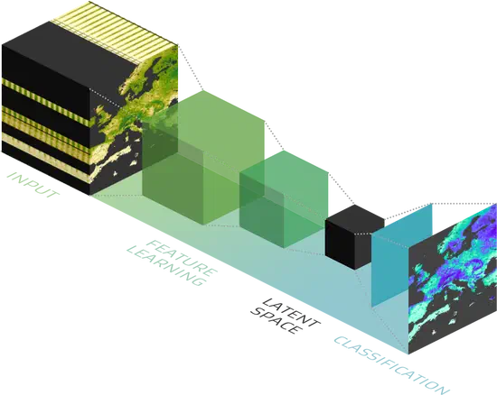
This project aims to create an holistic datacube with latent space variables based on Sentinel-2 spectral indices
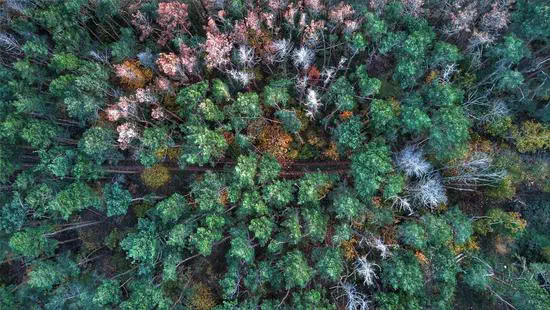
Digital Forest
Develop a near real-time forest monitoring concept and capitalize on latest advances in AI for predicting major impacts of climate extremes.
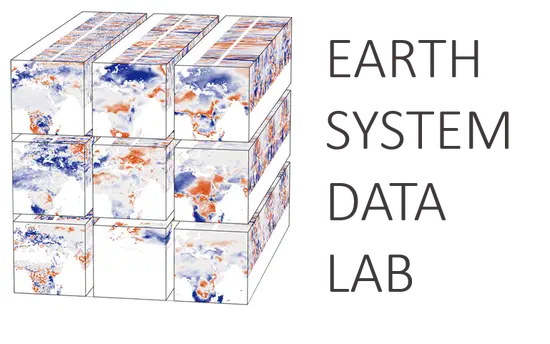
Earth System Data Lab
The Earth System Data Lab is a virtual laboratory providing global earth observation data sets and processing tools.
FlexFund
Intraspecific optical variability of beech trees within and across European stands in times of drought stress.
Forest Condition Monitor
Establishing a national forest monitor to assess and visualise vegetation condition for a better risk-management of German forests.
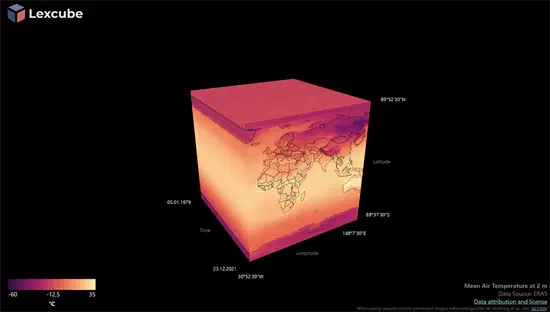
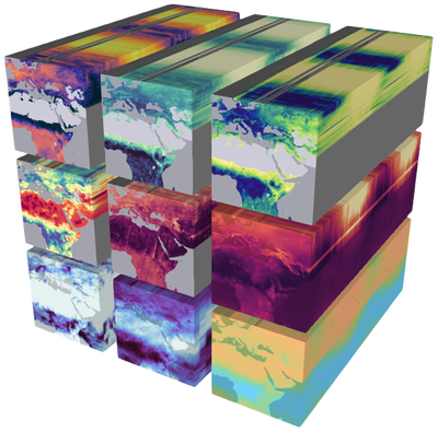
Lexcube
An interactive 3D data cube visualization of large-scale Earth system data
ml4earth
Deliver novel AI techniques for earth observation satellite data for studies in earth and climate sciences
MoDEV
The project MoDEV (Model-Data fusion for understanding Environmental Variability) investigates the interplay between carbon and water cycles for three biomes: forest, grassland and agriculture with special focus on the impacts of extreme hydrologic and climatic events as well their long-term trends.
NFDI4Biodiversity
Deliver practical tools for researchers and improve data availability for environmental studies/ecology.
NFDI4Earth
Addresses the digital needs of researchers in Earth System Sciences with the aim to understand the functioning of all subsystems of the Earth system and their interactions.
PARSe Biodiversity
Biodiversity effects on Plant-Atmosphere interactions analysed with Remote Sensing (PARSe Biodiversity)
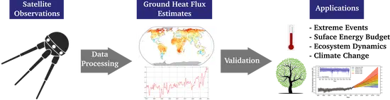
Satflux
Project to derive long-term, near-global ground heat flux estimates from satellite remote sensing data. These estimates will improve our understanding of the recent changes in subsurface conditions and will allow to estimate global changes in ground heat storage during the last 10 to 20 years
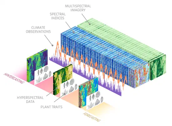
sPectra
More and more, ‘spectra’ of light’s reflectance across wavelengths from the surface of plant tissues are becoming an essential tool for monitoring plant function over large scales, especially when measured from aircraft or satellites. However, the range of ways that real plant spectra vary are still not well understood, hindering their interpretation. We propose to bring together large, diverse datasets of leaf and canopy spectra to identify and interpret the major dimensions of plant spectral variation.
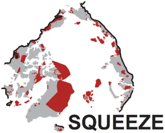
SQUEEZE
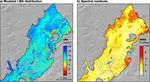
SQUEEZE: Arctic squeezing and tundra protection: opportunities, planning and communication. As part of an inter-institutional project, we are providing an assessment and evaluation of recent changes in the Arctic tundra. Based on remote sensing data and techniques, we analyze trajectories of drivers of tundra changes and their effects on functional ecosystem services.
TEE Cube
Time-varying AI-based mapping of ecosystem conditions and extents using multi-source Earth observation data cubes - TEE cube
Virtual Lab
The Virtual Lab provides computing infrastructure for teaching.
Featured Publications