RSC4Earth
RSC4Earth
Home
Mission
Team
Principle Investigators
Remote Sensing in Geo- and Ecosystem Research
Earth System Data Science
Remote Sensing Department at the UFZ
Geoinformatics and Remote Sensing
Support
Projects
Publications
Featured Publications
Recent Publications
Contact
Data
Photogrammetry
Unmanned Aerial Vehicle-based Mapping of Turf-banked Solifluction Lobe Movement and Its Relation to Material, Geomorphometric, Thermal and Vegetation Properties
Abstract Solifluction is one of the most widespread periglacial processes with low annual movement rates in the range of — millimeters …
Jana Eichel
,
Daniel Draebing
,
Teja Kattenborn
,
Johannes Antenor Senn
,
Lasse Klingbeil
,
Markus Wieland
,
Erik Heinz
Cite
DOI
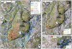
UAV Data as Alternative to Field Sampling to Map Woody Invasive Species Based on Combined Sentinel-1 and Sentinel-2 Data
Invasive plant species can pose major threats to biodiversity, ecosystem functioning and services. Satellite based remote sensing has …
Teja Kattenborn
,
Javier Lopatin
,
Michael Förster
,
Andreas Christian Braun
,
Fabian Ewald Fassnacht
Cite
DOI
PILOT STUDY ON THE RETRIEVAL OF DBH AND DIAMETER DISTRIBUTION OF DECIDUOUS FOREST STANDS USING CAST SHADOWS IN UAV-BASED ORTHOMOSAICS
Abstract. One fundamental metric to characterize trees and forest stands is the diameter at breast height (DBH). However, the vertical …
Teja Kattenborn
,
J. Hernández
,
J. Lopatin
,
G. Kattenborn
,
F. E. Fassnacht
Cite
DOI
Cite
×